By Albert Oppong-Ansah
Accra, March 7, GNA – The leadership of the Licensed Surveyors Association of Ghana (LiSAG) has acquired advanced surveying equipment to improve land information efficiency and accuracy for its members.
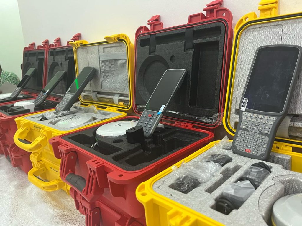
The Global Navigation Satellite System (GNSS) equipment includes a Global Positioning System (GPS), tripod, receivers, and software that captures, plots coordinates, and generates site plans for land registration processing by the Land Commission
Mr. Samuel Larbi Darko, President of the Assocation, who presented the first sets of equipment to members on Friday, stated that the migration from the old manual system to modern GNSS equipment would not only increase productivity but also help address many land litigation cases.
He explained that the initiative aligned with LiSAG’s goal of supporting its over 200 members by providing them with tools under flexible financial arrangements.
Mr. Darko, an engineer, mentioned that more equipment would be acquired as part of the association’s plan to ensure each member was served.
He disclosed that the suppliers of the equipment were ready to provide full technical training and after-sales service.
Mr. Darko appealed to the government to waive taxes on the importation and clearing of the equipment to sustain the association’s objective.
Mr. Stephen Djaba, Vice President of LiSAG, explained that traditional methods used total stations, which required line of sight to measure, often causing delays due to obstructions.
He noted that the new equipment enabled surveyors to quickly and accurately pick coordinates because it communicated with a satellite.
“With this new equipment, a surveyor, after picking the data, sends it to the office, and site plans are processed,” he added.
Mr. Jones Ofori Boadu, Deputy Executive Secretary of the Lands Commission, said that the move was in line with the Commission’s planned system, where core stations would be established to enable surveyors to access information for gathering land data.
“The core station serves as a base, so surveyors with this new equipment will quickly obtain their data. This means site plans, indentures, and other processes leading to land acquisition and registration will be faster,” he said.
Mr. Boadu acknowledged that obtaining site plans had previously been laborious for prospective buyers, but the new system would expedite the process.
Mr. Victor Kweku Ankobiaa, a surveyor, described the initiative as a “reliever,” noting that acquiring such equipment was expensive.
“I have four teams but we have one set of instruments and so we rotate it. We often receive many requests from clients, but the team has to wait for the other to finish. This financial arrangement will help a great deal,” he said.
Licensed surveyors are authorized to provide land surveying services on behalf of the Director of the Survey and Mapping Division of the Lands Commission, in accordance with the Survey Act 1962, Act 127, and the Lands Commission Act 2008, Act 767.
The aims and objectives of LiSAG include ensuring strict adherence to land survey laws in Ghana and collaborating with land sector agencies to formulate and implement policies that promote and protect land rights and sustainable development in the country.
GNA